Pages

Saturday, December 28, 2013

Walking city, transit city

Boston is a walking city. I don't mean that the land itself gets up and moves around (which is apparently a thing), but rather that the people who live here get out and walk as a major mode of transportation. Latest data show that 15.5% of Boston commuters walk to work, putting us in the top 5 of American cities. Adding public transportation, and it accounts for just over 50% of all commutes. Of course, work is only one of the many reasons that we travel, and we shouldn't focus entirely on it. If you live in Boston, there's a strong chance that you walk to many daily activities. Only 63% of Boston's residents have access to a private vehicle. If you examine neighborhoods individually, you can find many census tracts for which fewer than half the people living there have access to a car. Some even dip below 30%, particularly in the most densely populated parts of the city. In those areas of Boston, daily life conducted on foot is the norm.

Further out, where the streetcar lines helped settle early suburbs, there are corridors of activity which also correspond to low car ownership rates and population density. Public transportation acts as a "walk accelerator" making it possible to travel on foot over longer distances and faster than a person could sustain alone. The streetcars are mostly gone, replaced by buses and light rail vehicles, but many of the land use patterns remain -- despite decades of automobile-oriented public policy.

The MBTA has a "key bus route" program which has selected 15 bus routes for certain service guarantees about span and frequency. That's great, although a bit mysterious (why those 15?). The agency has slowly pushed for improvements in those particular routes, with the construction of the improvement program coming this year (finally). While a key route program might make sense from a transit agency's point of view, it doesn't necessarily correspond to the needs of urban neighborhoods, which are broader in scope. The city needs to consider land use and transportation together when make future plans. Historically those two subjects have been the purview of separate agencies, in Boston, and as a result, both have suffered.

Today, it's becoming fairly widely understood that the presence of a subway station ought to make a big difference in how development is conducted in the vicinity. However, that's too limited a view. I believe that concept should be extended further. Non-car surface transportation, whether it be walking, biking, trolley or bus, is far too important to be neglected in the overall land use and transportation planning picture. In addition, there are plenty of neighborhoods with current residents that deserve better streets and access to the city around them.

With that in mind, I drew up a rough sketch of a "key corridor" map which is loosely based on the idea of "key bus routes" but intends to have a larger scope that encompasses land use planning, pedestrian safety improvements, and bike routes as well. The light blue lines, dots and polygons are the places where walking, biking and transit ought to be emphasized. The black lines are connections that are outside the city's developmental scope, and there's also some regions highlighted in turquoise where future changes are anticipated. The map is far from complete, so I welcome comments. The core of Boston is largely omitted, since it should all be considered a "key" region.


You'll notice that many of the key corridors follow existing bus routes (key or not). That's because there is already a strong convergence between walkable areas and bus service. But the starting point is different. Rather than saying: "here's a good, frequent bus route" I am saying "this is a corridor near densely populated areas where people walk, and it ought to have high quality, frequent transit service of some sort." For example, the corridor between Roslindale Square and Forest Hills does not have a "key bus route" but it is, nonetheless, a very heavy ridership area and those parts of Roslindale are a fairly walkable area. Western Ave in Allston is another case, where the 70 and 86 buses are well-used but neither of them is a key route. That street is going to see some major development, as is the rest of Allston, and the bus stops along it ought to be designated for improved service. In addition to Allston, other neighborhoods on the map have historically been treated poorly by transportation planners, and have an existing population that can benefit from a commitment to expand the walking city.

Mayor-elect Walsh has claimed that he wants to conduct walk audits out in the neighborhoods, explore dedicated bus lanes, and better bicycling infrastructure. These key corridors could be the starting point for those kinds of improvements, as well as a land use planning process which is oriented around supporting walkable neighborhoods with convenient, frequent transit connections. A subway station is a fairly large commitment from the transit agency to providing "good service" in a particular area. A bus stop is not much by itself. But a planning process could make real guarantees about service, and give the same kind of commitment, and the same kind of environment in which to grow neighborhoods. We're not likely going to see too many new subway stations in the next few decades, especially with Boston's geology. So it's especially important that we are able to nurture walkable neighborhoods that are based around improved surface transit, and that new development gets directed into places where it can fit good transit geometry, rather than contributing to the traffic congestion and sprawl problem.

Monday, December 16, 2013

Some praise, but also criticism of Enrique Peñalosa's TED talk about cities


I have a few comments about Enrique Peñalosa's recent TED talk, which has been making the rounds. I'll say up front that he makes a lot of very good comments and it is worth watching. He's right: a bus with 80 people ought to have dedicated lanes. The streets should be safe for children and families. We have to rein in sprawl. But I have some criticism of the example pictures that he shows. I think that they undermine his message.

(all images are from the TED talk)


Here we see his example of a bus rapid transit system in his country. I'll say that from a technical perspective, it's pretty neat. Cheap labor costs, reuse of existing roadway, good ridership all make this a cost-effective project. The big problem is the location. This is highway-median transit. Look at what the people have to walk across just to get to the station. The 3 lanes of cars that you can see are only a fraction of the total. There's even more lanes of cars outside the frame of the picture, on the other side of the pointlessly landscaped median. This is about as anti-urban a scene as you can get. For all that he talks about equity for people, this is an example of a highway where the vast majority of the space is dedicated to private automobiles. And I think that this is a miserable example and it won't inspire anyone to want to copy it. It puts the transit in a very inhospitable location.


This is an example from Guangzhou, China. It's slightly better, in that there's only 6 lanes of traffic surrounding the busway. But it's still a hideously wide, Hypertrophic corridor: there's even grade separation of pedestrians. You can't cross this street without going up and over. It's a highway. If you want to talk about superiority over subways, then you need to show us a corridor with urbanism that matches what a subway can provide. This is not that. This is not human scaled. This is a massive hole in the city.


A terrifying vision, Enrique Peñalosa's "Radiant City"
Now, at this point in the TED talk is where Peñalosa goes off the deep end. The last 2 pictures could have been dismissed as just unfortunate choices. But this here is his "vision" of the city of the future. And it is HORRIFYING!

The picture painted here is one that might make Le Corbusier's heart warm. Towers in the park. Giant highways. Grade separated pedestrian ways. It's practically a compendium of what-not-to-do in urban areas. This is a vision which was implemented in 20th century cities and turned out to be a complete disaster (e.g. 1950s public housing projects). What in the world is Enrique thinking?


I picked out these two examples of streets with large pedestrian/bikeway areas. Actually, it's not clear if the top example even has a roadway for cars. The major problem with these two pictures is: where's the life? Both are in almost completely dead scenes. There's no street life. There's no "eyes on the street" because they're both set in desolate places. Instead there's tons of "buffering greenspace." These would make fine recreational paths through a park. But for a city street, these violate the first principles of safety in numbers. Perhaps this is not his vision for a city street, he's not entirely clear. I hope not. This is not the vision of a vibrant city. At best, it is the vision of an outlying suburb. Compare that to this picture he also shows:


Isn't that obviously much better? Life, people, a human-friendly street and neighborhood. Simple. But not from Colombia.

I don't know what to make of Enrique Peñalosa in this talk. On the one hand, he says lots of good things, and even shows some nice pictures from places like Amsterdam. On the other hand, he highlights examples from his own country that look like the worst of the tragic mistakes from 1950s urban planning.

Tuesday, December 10, 2013

Thought experiment: how much bus service can you get for the price of a parking garage?

Looking through some old data, I noticed that there's a common theme: the marginal operating cost per weekday of your typical frequent MBTA bus route is about $20,000. For example, the 1 bus is $18,456 while the 39 is $22,206. The 57 comes in at about $19,544. All of them are estimated to recover approximately half of that in fares, so overall marginal subsidy per day is about $8,000 to $12,000.

Mind you, the marginal operating cost only factors in the cost of running a bus per hour, plus the cost of driving it per mile. Maintenance, depreciation, administration and other facilities are not covered. But if they had the equipment lying around, then it might be fair to say that adding a weekday's worth of 57-like bus service costs approximately $10,000.

We know that excavating an underground parking garage can cost from $50,000 to $100,000 per parking space (sometimes more, sometimes less, depending on conditions). Speaking loosely, then, each underground parking space could cover the net cost of approximately 5-10 weekdays worth of key bus route service. Let's just assume for simplicity that every day has the same cost as a weekday. Then a year's worth of key bus route service could be covered for the same cost as 36 to 73 underground parking spaces.

A year's worth of bus service. (photo source)
Does this come up in real life? I think it's fair to expect several hundred parking spaces to be built along every core bus line every year. I can think of several hundred that came online along Comm Ave just last year, including some built at a deep (expensive) level. And another few hundred planned for Washington Street in Brighton. The Fenway is seeing plenty of garage construction despite the parking maximums in the neighborhood. Then a quick browse of the BRA's website shows 216 spaces (aboveground) for Kenmore Square, 236 spaces (3 floors below ground) on Harrison Ave in the South End, and 63 underground spaces on E Street in South Boston, just to pick a few examples.

I have been talking marginal costs up until now, but spaces are typically not added one-by-one. Instead, it's whole levels at a time. For example, a developer might propose 80 dwelling units and 60 parking spaces in an underground level. Some misguided neighbors might demand more parking spaces be added. But the only way to do that would be to go yet another level underground. Perhaps the developer can add another 40 parking spaces by doing that. The garage now costs about $5 to $10 million to excavate. Those costs are passed onto to the eventual tenants, and create more traffic and pollution in the area.

Alternatively, the developer could propose to pay for a year's worth of frequent bus service. The cost of adding that additional underground level could easily cover the marginal yearly cost of running a key bus route. Furthermore, doing so would help everyone in the neighborhood rather than a handful of car-owning tenants, would ease traffic and pollution instead of increase it, and would contribute to a better urban environment. And there's likely more than one such eligible development project per year.

I have heard people propose the option of replacing parking subsidies with transit subsidies. It's also a similar idea to value capture. It seems like it may be feasible after all. Some might say that it's unfair to put the burden of providing the public service on a private project (the usual objection to value capture) but I believe it is also unfair for the government to force people to subsidize parking spaces. If you're going to have parking quotas, which are ultimately harmful to the public, then it behooves you to allow them to be replaced by transit support payments, which are beneficial to the public.

Saturday, November 23, 2013

Bad parking policy, in one picture


On one side of the street, BTD has installed parking meters at the "usual rate" of $1.25/hour. On the other side of the street, the curb is left largely unregulated except for street cleaning. It shouldn't be too hard to figure out which side is which.

What you are seeing here is a case of poorly designed parking policy. The metered spaces have a price that is too high, and are therefore going wasted. The unmetered spaces have a price that is too low, and are therefore overcrowded. The correct price is somewhere in between, where "correct" means: achieves a reasonable level of utilization that still leaves a few spaces open for new arrivals. Prof. Donald Shoup's rule of thumb is that prices should be set to achieve approximately 85% utilization, which ensures that there will be at least 1-2 parking spaces available on every block, at almost all times.

BTD's bad parking policy and refusal to consider reform means that people continue to suffer unnecessary headaches, and they make claims of parking "shortages" even while most of our neighborhood is covered in asphalt. Although I don't own a car, I still find it important to fix. For one thing, it's the right thing to do. For another, bad policy in one area tends to infect other areas. Much of our land use policy, for instance, is dictated by the supposed "shortage" of parking. Even though about half the residents of this neighborhood don't have access to a car, they are forced by zoning rules to subsidize other people's parking. Those regulations came about because the on-street commons is managed improperly, creating an overcrowding problem. And then, instead of solving that problem the correct way, politics dictated bad ideas like "minimum parking quotas" which dump the burden onto the people who are least able to afford it, and also least able to oppose it.

This goes beyond just rent, and home prices. Economic development in this neighborhood is artificially depressed because of regressive policies like minimum parking quotas. The suburban-style space requirements of that many automobiles are too much for a compact city neighborhood. The net effect of this heavy-handed government regulation, to force more cars on us, is to squelch normal, healthy, incremental growth. Instead, we get almost nothing, and hardly any changes, for decades. That's a lot of lost jobs, lost opportunity, a heavy price to pay, all because of an irrational fear of parking "shortages" caused by broken policies that do not make sense in urban areas.

Monday, November 11, 2013

Help make the Cambridge Street overpass safer and better

MassDOT has called a second public meeting on the Cambridge Street overpass replacement with some updates. They intend to issue the notice to proceed in the early winter.


Despite some changes, the plan still calls for a fence down the middle of the street, blocking pedestrian crossing for over a quarter-mile. The plan does not address any of the existing ADA incompatibility issues, and it still calls for mixing of walkers and multiple streams of bikers by the Franklin Street pedestrian overpass.

Several advocates and community members have written a new public letter to the agency calling for more changes to the design. I encourage everyone to check it out and sign it, particularly if you live in the area. I also encourage everyone to come to the public meeting on November 19th, at 6 p.m., in the Jackson Mann school's auditorium.

Thursday, November 7, 2013

What does the election of Marty Walsh mean for walking in Boston?

The most significant local Boston election of my adult lifetime, to date, has come and gone. The new mayor will be Marty Walsh. So let's take a look at some of the things he said in forums and questionnaires gone by:

With one exception, I thought that his response to the Transportation Forum questionnaire was pretty good:
To me, livability means the ability to leave your house and have things to do outside. In my neighborhood in Savin Hill, I can go out and walk down my street feeling safe knowing that a few minutes away I have a park or coffee shop to go to or a T station that can take me into town. Livability means access to things that make life enjoyable, like amenities, recreation and transportation, among others. This city has so much to offer and we need to make all of those offerings accessible to everyone.
Simple and clear. And something that he has lived. Boston will have a mayor who lives in a walkable neighborhood, within 5 minutes of a rapid transit station.
[...] "Walk audits" performed by advocates are a good mechanism for getting concrete details about the safety, spacing, and timing of our street intersections and traffic signals, among other details. Boston's transportation planning should not only incorporate, but actively solicit this level of feedback. In addition to holding regular community meetings around planning, and scheduled walks, we can market and develop the city's digital tools to ensure that transportation input is easy, detailed, documented, and sufficient. Boston's next mayor can build a safer city where residents feel comfortable in their own communities. Meeting the needs of walkers throughout all areas of the city is important for many reasons. We need to make sure pedestrians are safe everywhere. Boston's Complete Streets is doing great work around making the streets safe for everyone.
[...] I think a Boston Walks Director is a good idea. However, that person will need to focus on the whole city and not just Downtown. It is a big task but I believe pedestrians will have a much easier time under my Administration.
If he follows through on this idea of "walk audits" and continues to support the Boston Complete Streets effort, then I think we are in pretty good shape. And he is right that a Boston Walks Director should focus on the entire city.
I would work with the MBTA to explore dedicated bus lanes on high-density, underserved routes and work to implement an Urban Ring service. I would also work to reach out, listen to, and incorporate the ideas of Bostonians in all transportation planning. This can be accomplished through annual neighborhood meetings with the Mayor and regular communication with residents through Little City Halls. I would also add targeted outreach to non-English speakers and communities of color to make sure all Bostonians are being heard. I would also make it easy for people to comment on transit problems through platforms like Citizen's Connect, mobile apps, and other technological means. Things get done when people's voices are heard, and as mayor I will make sure the MBTA runs as efficiently as possible.
The mayor does not have direct control over the T, as Marty has pointed out on other occasions, but he does have control over the streets. So creating dedicated bus lanes would be one way the city could improve bus service directly. Admittedly, he just talks about "exploring" it, not really a commitment of any sort. For what it's worth, his responses to this questionnaire do match up with his campaign platform.

The one exception, if you are still wondering, is his stated support for the Casey Overpass. However, this position was walked back in a later interview. I think he genuinely does care about process, and bridge-favoring activists may have led him to believe that it was insufficient in this case, a misconception that was later cleared up.

From the Boston Globe's questionnaire:
I am a strong proponent of expanded late ­night T service, and, as mayor, would coordinate with the MBTA and MassDOT and work with businesses (24­ hour businesses, restaurants/bars) and colleges and universities to assess demand. The most realistic funding approach is probably a mix of state aid and creative public­ private partnerships here in the city. Having represented Boston for 16 years on Beacon Hill, I am the candidate best positioned to win the necessary support from the Legislature. Beyond that, I would work with private institutions, especially universities whose students are likely to be major users, to fully fund the extended service.
Okay, sounds reasonable. More on this in the future.
Different policies should apply to different areas of the city depending on local parking situations. Minimum off­-street parking requirements should be required for new residential development in neighborhoods where parking is at a premium. Incentives could be provided for those developers to promote transit ­oriented development which would require less parking.
Not the greatest answer, but not terrible either. As long as transit oriented development means parking quotas are significantly lowered or eliminated, then it will work out. I find the hint of "incentives" to promote transit oriented development intriguing, though it should be unnecessary.
An ideal “cycle track” is safe and allows easy access for bikers to get through the city quickly. “Cycle tracks” can only be implemented where there is adequate right­-of­-way. There are many additional factors involved in choosing appropriate locations, such as parking and connections to other bike lanes and/or facilities.
I know this isn't quite about walking, but I find this a fairly uninspiring answer to a question about cycle-tracks, which is disappointing because he has given decent answers in other places, such as the Boston Cyclists Union questionnaire:
Yes. Biking is becoming more popular in Boston and we are not keeping up with the need for proper infrastructure that will keep our bikers safe. As Mayor, I will work to bring more cycle tracks and bike lanes to Boston, especially in busy areas where accidents are common. Bikers need to feel safe on our streets, and that means more bike infrastructure, more cycle tracks and bike lanes, and better transportation planning throughout the city. A Walsh Administration will make biking a priority because it is a safety issue, and all Bostonians deserve to feel safe in our city.
Now, from an interview about housing development from the Globe:
Ideally, increasing the overall supply of housing should help to meet demand and moderate rent increases. The demand is so strong, however, that even as new apartments are built, rents continue to increase. As a result, the city is increasingly unaffordable for many of its residents.
I'm glad to see that he understands the basic structure of the problem. Some self-styled "progressives" mistakenly think that building more housing results in higher prices, because they get confused when the strong demand outstrips the small increase in supply.
We must proceed with caution with relation to reducing parking in our residential neighborhoods because we must take into account the many young families with children who need access to a car as well as residents in our southwest corridor neighborhoods who don’t work downtown. I support policies that make it easier for people to get around Boston without a car. I want to make sure every resident of Boston lives no more than a five minute walk from an accessible form of alternate transportation, by extending HubWay and Zipcar into our neighborhoods, installing new car charging stations for electric cares out in the neighborhoods and modernizing the MBTA system.
An answer that's trying to have it all ways, and one that obfuscates the question, which did not ask about reducing parking, but rather, about reducing parking quotas. At some point, there will be an unavoidable conflict between livable, walkable neighborhoods vs minimum parking quotas. To which side his policies will lean towards is still an open question.

Marty wasn't my first choice, but I did ultimately end up voting for him. Both of the remaining candidates after the preliminary election had plenty of nice things to say about improving walkability, bicycling conditions, public transit, development of housing, jobs, and a host of other important issues. But that's just words, and campaign promises are cheap. I didn't have anything more solid to base my vote upon, so I had to go with my gut. I felt that Walsh would be more likely to follow through, so he got my vote. In the coming months, it'll be important to continue to advocate and make sure that the good parts of the Menino era are continued, such as Boston Complete Streets and Boston Bikes. There's been a lot of hard-won progress in the last few years. I don't think we're going to regress, but it's always important to keep pushing and reminding politicians of the value of walkable neighborhoods.

Sunday, October 20, 2013

Conservative traffic studies are radical, part 2

Last year I wrote an article entitled "Conservative traffic studies are radical" about the New Balance project traffic study that presumed, as usual, an increase in traffic volume of 0.5 percent per year. I pointed out that this assumption was untrue for the past ten years, using data from MassDOT. At a public meeting, I was able to confirm this data with the consultant that was hired to do the study. But he labeled the 0.5 percent per year assumption as a "conservative" one.

I believe it is disingenuous to call this a conservative estimate because the implications are radical. These kinds of predictions can be used as a weapon to justify deadly street widenings at the expense of the neighborhood. Historically, many widenings were brought about due to fear of increased traffic. Of course, we know that wider roads may induce additional traffic, so no problems were typically solved this way, and the result was usually more dangerous to pedestrians.

With this in mind, as I was reading through the Hotel Commonwealth expansion project PNF, I noticed this very interesting table and quote:


As shown in [Table 2-4], traffic at the specific stations has decreased within the given timeframe. In order to remain conservative, this study assumed a traffic volume increase of 0.5 percent per year.
I suppose that this represents progress, in a small way. In the past, I had to push for the project consultant to admit, in person, that traffic volumes were actually declining. Here, it is written in print. However, the evidence presented has not stopped them from making the strange leap to the usual assumption: "0.5 percent per year."

I find this to be a very strange definition of "conservative." Shouldn't that mean expecting an existing trend to continue? If traffic volumes are declining in recent years, then might they not continue to decline? Especially since we know that traffic volumes are largely a function of provided roadway space. Instead, it seems that traffic "experts" have redefined the term "conservative" to mean "does the exact opposite from the trend."

Well, all I can say is: they wouldn't be the first people to redefine "conservative" to mean something much more radical.

Tuesday, October 8, 2013

New MBTA map announced

New MBTA map design from Mikheil Kvrivishvili (see also: larger PDF from UHub)
Congratulations to Mikheil Kvrivishvili for winning the contest. First, before I jump into criticism, let me just say that the map has many fine features and represents a great deal of effort performed at great risk. The MBTA's copyright policy on this contest was barbaric, essentially demanding that artists hand over their rights to their work without any idea of what would happen next. I hope that MBTA management is working out a suitable arrangement with Mikheil for what was essentially free labor; the free publicity generated for him is a start. I also hope that the MBTA will do the right thing and return the rights to the other maps back to their original artists.

The design is clearly a conservative approach, duplicating many style elements of the existing map. However, I think that there were some places where the MBTA really should have looked for some significant change:

The map doesn't really do frequency mapping and even takes a step backwards. Frequency mapping means that the width of the line on the map has some relationship to the frequency of vehicle arrival on the ground. Several designs were submitted that showed the Green Line frequency being cut to one-fourth on the surface branches, compared to the subway. Anyone who has ridden the Green Line "B" branch knows that it is unfair to categorize it in the same class as the Red Line through Cambridge. Yet, that is what the current and new maps do.

The T actually asked designers to make the key bus route lines smaller, and now the commuter rail lines are bigger! For example, this is confusing to a person trying to get from Hyde Park to Back Bay at an arbitrary time of day. The commuter rail looks like the more important element of the map, but it only stops there twenty-one times a day, with a huge gap at peak hours. The 32 bus is generally the more usable option.

The map is worse than the current one at depicting geographic relationships. Yes, of course, it's not supposed to show accurate geography. But introducing cleverly chosen hybrid elements of geography can help users make smarter decisions about selecting one line or the other, or perform out-of-system transfers. A big loss that stands out to me is the disconnection of Cleveland Circle and Reservoir. These are essentially the same station, with track connection via the Reservoir carhouse. Travelers going between branches of the Green Line can exploit the proximity of the "C" and "D" (and also nearby "B") at Cleveland Circle to save time and avoid transferring at Kenmore. Instead, this new map depicts the three branches as being further apart than Heath Street and Forest Hills -- stations which are not at all close to each other. Another one is Copley/Back Bay, which is a major Green/Orange/commuter rail out-of-system transfer, but is not even hinted at by this new map, despite being in a heavily touristed area. Well, at least the depiction of the 39 bus route is fixed.

In other places, geography is inexplicably included: the Needham line being a prime example. Why is it relevant to show that the Needham line curves northward? That could have easily been a short strip of station names. Why is there a dip in the Newburyport line near Chelsea? That's a useless geographic element. Why does the Blue Line take a sharp 90-degree turn -- making it ugly and exceptional -- while the Green Line does a soft turn between Haymarket and North Station? Why is the Silver Line airport loop reduced to a tiny note, while the nearly irrelevant downtown meanderings of the Silver Line occupy a huge portion of the map?

It appears that a significant compromise was made in order to include all of the Green Line "station" names. This is a really puzzling goal. Many of these "stations" are just strips of asphalt, or a post in the street, located two blocks away from each other. The names of the Silver Line stations are smaller, but not really any less significant. I don't think it was worthwhile to give up all geographic cues about the Green Line in exchange for full, large-font station names that are nearly the same font-size as the major underground stations. Shouldn't we be working on eliminating some of these ridiculously bunched stations, anyway?

Is Chestnut Hill Avenue "station" nearly as important as Kenmore?
St Paul Street "station" is only slightly better. Is this really comparable to Copley?
The new map includes Assembly Square, which isn't open yet. Fair enough. But why not the upcoming "Boston Landing" commuter rail station in Brighton? That also reveals a geographic error: the 57 bus and the Framingham line are mixed up. Without the new station, it wouldn't really matter. But with the new station, it's important to ensure that the 57 bus is shown south of it, especially if the MBTA wants to encourage walking transfers between them.

The MassPort shuttle buses at the airport continue to be de-emphasized, which is unfortunate. They are actually quite decent, especially with the new low floor buses, and new real-time countdown boards, which are also integrated with the Silver Line. I personally prefer using the Blue Line to Logan, but it seems that the MBTA is trying to push all the tourists towards the Silver Line (not to mention the free fares!). Actually, on second thought, I'm okay with this.

The new map design is an improvement on the old map and a significant clean-up. I think the major flaws are: missing the chance to do frequency mapping, emphasizing commuter rail over key bus routes, compromising geographic elements for Green Line "station" names, failing to hint at sensible out-of-system transfers, and turning the Silver Line airport loop into a line, somehow.

Tuesday, October 1, 2013

Car-free housing in Boston is natural

(Also check out Paul McMorrow's rebuttal: Boston could be car-free, it's how people actually live.)

There are so many flaws in Tom Keane's most recent column for the Globe, that it is almost too easy to pick it apart. Take the first sentence:
CAR-FREE condos and apartments, the latest fad in residential living, are really little more than a gimmick: good for greens and developers, perhaps, but bad for residents.
The "latest fad?" I suppose that Tom believes that 19th century apartments were built with parking spaces? A little bit of history tells us that minimum parking requirements began with the 1950s zoning codes, a fad of its time, and the result was decades of disaster and urban decay. Then there's a little shot at people who live without a car: according to Tom, they must be either those wacky, crunchy "greens" or some market cooked up by sneaky, greedy developers. According to Tom's reasoning, these dastardly developers are just itching to dump millions of dollars creating a product that nobody will buy.
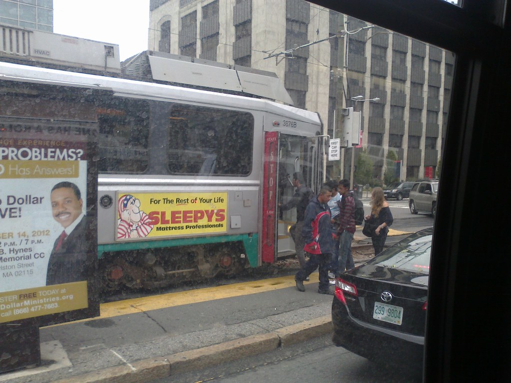
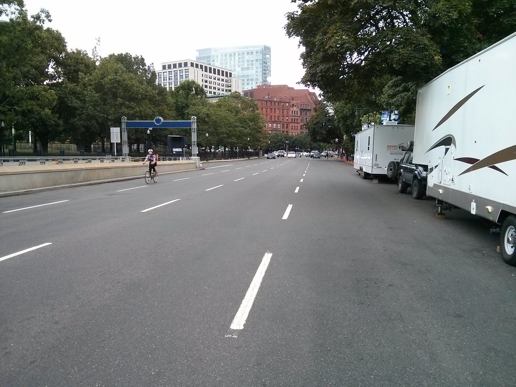
Thus, real estate developer Related Beal LLC is now proposing to create 175 units near TD Garden without adding in any new spots. 
There’s a certain sleight of hand to the idea, since residents wouldn’t have to abandon their cars. As Related Beal acknowledges, it’s hoping to piggyback off of existing nearby parking. So this isn’t actually a car-free building as much as it is one that dumps the problem on someone else.
I feel strange explaining the concept of a market to someone as old as Tom Keane. The idea that residents could rent or purchase a parking space in a nearby garage should not be that difficult to grasp, and it's not much different from the many other transactions which take place between residents and local businesses. For example, most apartment buildings are not constructed with grocery store requirements. However, most people seem to understand that when a resident wants a bottle of milk, they can walk down to a nearby store and buy one. We do not need to build "minimum grocery store requirements" into the zoning code because those products are handled perfectly well by normally operating markets. And parking spaces are no different. They are just one type of land use, among many, that can be purchased or leased on the real estate market.
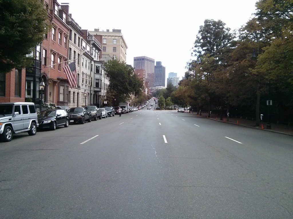
But suppose new buildings truly were car-free, with residents somehow compelled to give up their cars? A few might be persuaded to do so, but in the long run such a proposition would run headlong into one big problem: Even in Boston, people need cars. Manhattan, a uniquely dense and compact island, can get away with car-free living. Boston, spread out and part of a much larger metropolitan area, cannot.
Well, I just pointed out that there is nothing stopping a person from renting space for their automobile, much like they rent space for their bed and belongings. But the second part of this paragraph is hilarious. It makes me wonder if Tom has ever actually visited New York City. Actually, I'm starting to wonder if this former Boston city councilor has ever visited Boston, a city that prides itself on being a "walking city" with a compact urban area. Manhattan, just one piece of NYC, is much larger than Boston proper. Yes, that borough is densely populated, unique, and "can get away with car-free living." Boston is also densely populated, unique, smaller, and has many residents who "get away" with car-free living despite Tom's protestations.
As much as some may denounce the automobile, almost all of us own one — about 91 percent of American households, according to the US Census Bureau. In Boston, as in other cities, the numbers are lower, with only 63 percent of households having a car.
Tom gets weird here: it's true that 91% of American households own a car. Well, so what? 99% of American households don't live in downtown Boston! What's the relevance of choices made by people living in Marion, Ohio to a development project in Boston? Approximately nil. But let's move on. It's true that according to the American Community Survey, approximately 63% of Boston city residents have access to a car. That number is more relevant, and significantly lower. What's even lower: the number of residents with access to a car when you focus on the neighborhoods around downtown Boston.

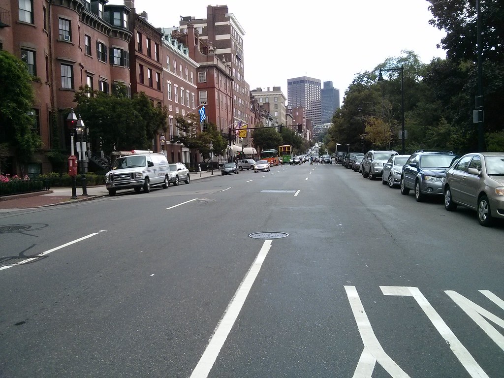
  • Beacon Hill census tracts: 33%, 40%, 47% have access to a car
  • West End census tracts: 50% have access to a car
  • North End census tracts: 26%, 31%, 33% have access to a car
  • Waterfront census tract: 40% have access to a car
  • Leather District census tract: 43% have access to a car
  • Chinatown census tract: 27% have access to a car
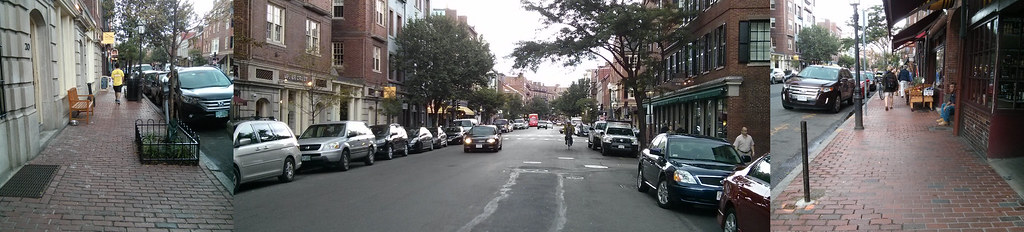
All of these numbers are significantly lower than 63%, the citywide rate, because the citywide numbers include some extremely suburban areas such as West Roxbury and Hyde Park, where the car access rate can exceed 95% in some tracts! But we're not talking about development in West Roxbury. We're talking about development on the Shawmut peninsula, which has been an urbanized settlement for centuries, long before the invention of the automobile. And it continues to be place where people live with low rates of car access.
Sometimes that’s an income issue; buying and maintaining a vehicle is expensive. Still, there are many city dwellers — mostly younger people — who choose not to have a car as a lifestyle decision. They can get to work without one, and find it easy to walk or bike their way around town.

Good for them. But merely because someone chooses not to have a car right now doesn't mean things won’t change. Green intentions notwithstanding, as life goes on it becomes increasingly likely a car will come into the picture. 
Living without a car is the norm for the majority, in some cases, the super-majority, of people living today in central neighborhoods of Boston. But according to Tom, it must all be either poor people, young hipsters, or environment-saving die-hards. I have trouble believing that 70% of the North End, 60% of Beacon Hill, and 73% of Chinatown is populated in this narrow fashion. But this is essential to Tom's argument, because in his view, they can all be dismissed, because they are not "real Bostonians." That's the undertone of his argument, in any case. Let's look at the text:
The average American, for example, changes jobs frequently (well more than 11 times during a working lifetime, according to Bureau of Labor Statistics data). A new resident of a car-free building might be working just down the street. But two years later, another position might beckon, located, say, at one of the many office parks that have sprouted up along Routes 128 and 495. [...] More likely, the once car-free resident will end up buying a car and moving to a place that’s more auto-friendly.
Put aside the falsity of using "average American" here. And let's also put aside the likely possibility that a new job can easily open up in downtown Boston just as much as it might on the highway belts. Suppose this hypothetical resident changes to a job located on the Route 128 belt and it's not transit accessible, so they are forced to buy a car. And then they have a choice to make: either rent a parking space, or move to another home where they will also rent a parking space (but possibly cheaper).

So... what's the big deal, Tom? People make this kind of decision about their life all the time. There's no Commandment that states: "Thou shalt not have to make any difficult decisions about the cost of parking." The cost of housing and the cost of transportation -- which, for cars, includes parking -- is a factor in just about everyone's living decisions.

We live in a free country, free as in liberty, not free as in "free parking." That means we're supposed to have the ability to make choices. That also means we accept the consequences of those choices. If I choose to live in a building with no parking spaces, then that means I must later choose to rent a parking space if I choose to buy a car. Not much different from choosing to live in a 1-bedroom apartment. If I later decide that I want a second bedroom, then I need to either rent one, or move to another apartment which has one.
Then too, as people couple up or have kids, the need for a car rises. In Boston, most of those without cars are singles — fully 50 percent. But as household size grows, the rate of car ownership climbs to 75 percent. Anyone with children can understand why; parents spend their days shuttling their kids from playdates to school to sports to after-school activities. Cars are a necessity. By making it a hassle to own one, we push families out to the suburbs.
Aha, now we get down to it. According to Tom, it's impossible to have a family without a car. Well, not so impossible that 25% of car-free households do it. But impossible, nonetheless! Obviously, there were no families prior to the invention of the automobile. Humans sprang fully formed, with 2.5 children and a home with a white picket fence, from the bowels of Henry Ford's Model T plant.

I kid, but let's take his paragraph apart and see the real driving force here: "Anyone with children can understand why; parents spend their days shuttling their kids from playdates to school to sports to after-school activities."

That's the nub. Tom Keane is fully committed to the idea that parents must spend their days shuttling their kids between social and educational activities. It probably has never occurred to him that the reason why parents are forced to shuttle their kids around is because they are growing up in a suburban environment where it is unsafe to travel in any other way but a car!

We, as a country, have spent much of the latter half of the 20th century building a living environment which is downright hostile and dangerous to children: suburban sprawl. Wide roads, desolate stretches, miles of nothingness between life. There is, indeed, only one way to traverse these deserts, and that is a car. So, if Tom Keane were writing about some development project out in the boonies, and not in the heart of the city of Boston, he might have a point.

But we're talking about development in a densely populated urban area. A place which is known for its walkability. A place where the majority of residents already live without cars. Let's think about context: the prescriptions that apply to sprawling subdivisions don't make any sense at all in middle of Boston. The lifestyle of parents in faraway exurbs is not comparable to that of parents in a compact city. One final claim:
Cars are a necessity. By making it a hassle to own one, we push families out to the suburbs.
Cars are not a necessity. We are not "making" it a hassle to own one. That "hassle" is just part of the nature of living in an urban neighborhood. It will never be like living out in the suburbs, and no amount of parking garage construction will ever change that. Face it: if a family wants the suburban experience, then they will end up moving to the suburbs no matter how much you try to bend over backwards to squeeze cars into the city. Meantime, you will damage the quality of life for families that are trying to live in the city. We can't compete while playing by the suburban rulebook. It's impossible.

What the city can offer is an alternative to suburban or exurban life, and yes, that extends to families as well. In the city, you have a chance to build an environment that values human life more than automobile convenience. In the city, you don't need a big backyard because the shared public space, the parks, the streets, the freedom of the city, gives you a much more interesting and diverse place to be. And that applies to children as well, who don't need to be "shuttled" by private vehicle to every place in their lives, but could actually attend their activities by walking around the local neighborhood, and learning to be self-sufficient. This is how urban neighborhoods have functioned, successfully, throughout history. This is the advantage that urban neighborhoods have over suburban neighborhoods, and it serves nobody any good to throw it away.

Minimum parking requirements are a failed, urban renewal-era experiment which are leftover from the bad old days. It is long past time to end them, and start focusing on building great urban places which won't make people feel like they need a car to escape.

Thursday, September 19, 2013

Why I am voting for Mike Ross

Normally I try to stay out of explicit politics on this blog, but there's a huge election coming up on Tuesday: the preliminary election for Mayor and City Council, and it's the biggest one of my generation. With Mayor Menino retiring, there's 12 candidates competing to be the next mayor. There's also 19 City Council at-Large candidates. The preliminary election will narrow the field of mayor from 12 down to 2, and it will narrow the City Council at-Large candidates from 19 to 8.

It's one thing to work on general activism for walkability and public transportation. But the actual policy gets made by elected officials. So it's important to engage with them. And during election season, that means talking to them about issues that are important to you. And finding candidates that agree with you, and helping them to get elected. All the great ideas in the world are not going to help anyone unless you can get elected, or get someone elected who believes in those ideas.

I collected a series of notes earlier about housing issues, but yesterday was the Transportation Forum, and I'm going to refer people to that because there is video and a great questionnaire that goes along with it. Also the Boston Globe published their transportation questionnaire. We're lucky that there's been a lot of focus on transportation and livability issues this cycle. That means that many of the candidates have had to speak about their plans, and at least give lip service to the ideas of promoting walking, biking, public transit, housing development, economic diversity and the like. Maybe it even means that whoever wins will follow through on those promises. With some of them, we can only hope they won't go back on their words.

There is one candidate that I know will be good on these issues and that is why I am voting for Mike Ross in the preliminary election. I don't know if he will be one of the two candidates to pass the threshold next week. There's far too much uncertainty in the race to make any sort of prediction. However Tuesday turns out, I have chosen to support him because I believe he represents the best choice on the issues that I find most important, on the themes that I often cover in this blog.

Experience

Mike lives in Mission Hill and represents District 8: including Mission Hill, the Fenway, the Back Bay and Beacon Hill. Of all the candidates, he lives closest to Boston proper. He's represented that district for over 13 years including 2 years as City Council President. Given the choice, I would prefer that Boston not continue to be ruled as a colony of its outer suburbs.

His district includes densely populated residential areas, bustling commercial and mixed use areas, big institutions, major parks, much of the Central Subway and it borders a stretch of the Southwest Corridor. In other words, he has a lot of experience dealing with urban issues.

He lives on a street with a big hospital along one end, and many student-occupied houses adjacent. He has to deal personally with the kind of issues that would be more abstract to someone who lives far away in, say, West Roxbury or Hyde Park, but all too real to someone who lives in Mission Hill, Allston or Roxbury. I think that kind of lived experience is important to have in the mayor of a city like Boston.


Community Organizing

In the past decade, he's helped bring about the revitalization of the West Fens. A stretch of Boylston Street near Fenway Park used to look like a slice of New Jersey: parking lots and fast food chains. Now it's under intense development as a whole new urban corridor, with high-rises and mixed-uses. It's bringing life to an area that's close to downtown but was largely ignored as a Red Sox fiefdom for decades.

At the same time, he's managed to do it in a way that has community buy-in. In other parts of the city, the community bitterly fights any attempt to bring development and life into the area. In the Fenway, he brought together many parties to sit down and plan the development, and as a result, people are happy and welcome the changes coming.

For a nice change of pace, the plan actually includes parking maximums set at 0.75 / unit as well as language and design plans talking about the importance of making a walkable place that is not overwhelmed by cars. Yes, that's right: plans developed through community process that call for fewer parking spaces and more urbanity. I find that very impressive.

Housing

I would say that one of the first aspects of his stump speech that stood out to me is his emphasis on the need to build more housing. And not just a little trickle, but large amounts that will help relieve the enormous pressure being put on the neighborhoods. Like in the Fenway, he emphasizes the importance of bringing the community together and planning for the housing expansion, so that it will be done fairly and predictably. But he also emphasizes the need for more than just housing: there are also the amenities which make living in the city feasible and desirable. Markets where you can buy fresh produce and other food. Restaurants where you can go out and socialize. A diversity of retail to bring jobs and life to neighborhoods. And all within walking distance, to make a place that you don't feel forced to drive away from, but rather feel welcome to stay and live in. His answer to the first question of the Transportation forum questionnaire encapsulates this, what he speaks about while on the campaign trail:
I am fortunate enough to live in an extremely livable community, Mission Hill, one that helps to identify for me what the definition of that word truly is. I have access to numerous forms of public transportation like a bike share hub at the bottom of my street, the Green Line on Huntington Avenue, the Orange Line at the other end of Tremont Street next to Columbus Avenue, the bus; the options for getting around the city are limitless. There are community staples--a community health center, a grocery store that provides fresh and healthy food options as well as affordable restaurants are all within walking distance. This is a community that is thriving due in a large part to it's livability and every neighborhood deserves to have this equal access and opportunity.
I hope that you can see why I judge the importance of living in an urban neighborhood of the city so highly. There's a lot more in his housing plan as well, worth a read.

Transportation

More than any other candidate, Mike Ross has made public transportation a centerpiece of his campaign. To publicize the release of his Transportation plan, he opted to campaign for three days without a car -- a difficult task given the MBTA in its current decrepit state. The Boston Globe called it a "gimmick," but it was more than any other candidate dared to do, and I think that shows just how out of touch the Globe is. For some of us, going car-free is not a "gimmick" but our everyday lives.

Mike has worked on transit issues in the past. The Night Owl was an attempt to provide late night MBTA service from 2001 to 2005 that Mike pushed for back when he first arrived on the City Council. It wasn't able to be made sustainable at the time, but it looks like the time is ripe for it again, and he has pledged to bring it back as mayor.

He believes in the importance of transit oriented development:
Transit-oriented development (TOD) has the potential to spark investment in parts of our city that need it most. Mixed-use housing and commercial development in close proximity to T stops supports MBTA ridership, sustainable development, and creates greater connections for neighborhoods.
[...] As Mayor, I will improve and modernize zoning and permitting processes in order to facilitate more transit-oriented development in Boston to promote greater transit ridership and create more sustainable and livable communities. A successful public transit system is dependent on riders' access to transit stops. Promoting mixed-use housing and commercial development in close proximity to T stops and transit hubs makes taking the T an easy option for residents. It's also a sustainable way to develop our neighborhoods and jumpstart business districts near T stops.
And he is also supportive of reducing the destructive parking quotas which have been plaguing our city since the 1950s. Furthermore, when asked about parking around the city, he responded by talking about the possibilities of "parking benefit districts" (see also this PDF) which is absolutely stunning to be hearing from a potential mayor. This is the kind of thinking which lives up to the slogan "Boston Smarter."

Although I'm not personally much of a bicycling activist, I do support it, and his Transportation Plan pledges to make Boston the #1 city in America for cyclists, and lists a number of ways he intends to go about it. That includes hiring a transportation director with a strong cycling background, building more cycle tracks, and adding more bike lanes elsewhere.

Also, if you haven't read his response to the Transportation Forum questionnaire yet, I recommend it.

Other issues

Mike worked to bring food trucks to Boston and pushed back against entrenched bureaucracy that didn't want to be bothered dealing with it.

He was willing to bring in ideas from other cities to improve our public spaces. Such as in the Common, which now has a new sandwich shop. That replaced a decrepit structure that was blighting the vicinity, and the idea came from NYC's Central Park.

When he first took office, the Red Sox were prepared to scrap Fenway Park -- in his district -- and demand a large subsidy from the city to replace it. Instead he worked to convince the owners to renovate the park, not replace it. Personally, I like baseball, and I like Fenway Park. But even if you don't care for baseball, thanks in part to his efforts, the city wasn't weaseled out of a half-billion of taxpayer dollars or worse to build a new stadium. I think that's a win for good government.

In 2008, at the depth of the recession, the firefighters union demanded a huge raise that would have cost the city an extra $45 million it didn't have. Libraries were going to be closed, including one in my area. Mike was able to negotiate with the union leadership and save that money, save the libraries, and do it without alienating the union. I believe in the importance of unions, and yet, also believe that they are just one side of the balance that needs to be maintained, with the needs of the public represented strongly by elected officials.

The topic of schools is admittedly out of my element, but, I am happy with his plans: more availability of vocational schooling at the upper end, early pre-K at the lower end, and a longer school day for arts. I know he also worked to get an elementary school opened in the North End (actually in the old Romney HQ) which is the first one in the area since the 1970s. That's pretty cool, and will help families stay in the city.

Conclusion

I think that housing and transportation policies have many side effects on a wide variety of city issues, ranging from safety, parks and public health, to education, as well. That's why I focus on those two. It's important to have a diversity of housing options to suit a diversity of people and their economic means. Otherwise you end up with a segregated society. And it's important to have neighborhoods where people feel safe and welcome when walking. Our streets are our largest public space, and if they become depopulated, they become unsafe. If parents don't feel safe, then they won't let their kids walk, and then those kids will lose out on the main advantage of being in a city: having a place to grow up which is bigger, more engaging, and more diverse than your own backyard. Not all learning occurs at school. If children are being shuttled around between controlled locations exclusively by private vehicles, then what's the difference between that and being in a sprawling suburb?

As you may have noticed, I've spent a long time thinking about this. Probably too long. I may not change anyone's mind, but I'm hoping that this discussion may help someone looking for help with deciding. These are the issues that I find important, and these are the reasons why I am voting for Mike Ross for mayor.

Friday, September 6, 2013

The streets around the Public Garden


There is an upcoming public meeting to discuss the possibility of a two-way cycle track around the Public Garden. I encourage people to attend. The mess of one-way streets around the Public Garden (and around downtown Boston) makes it difficult for bike riders to get around safely. It's good that they are looking into fixing this. Perhaps it can integrate with Connect Historic Boston. But there's so much more to these streets than just cyclist safety, as important as that is.

As anyone who has lived, or visited, here knows, the streets around the Public Garden and the Common are some particularly nasty, wide, one way racetracks. It seems absurd: the Public Garden being one of the jewels of Boston with so much money and effort invested in it, yet it is surrounded by a sea of pavement. How did it get to be so screwed up?

Well, we've heard about the dirty 1970s and the damage wrought on this city by traffic engineers and leaders who seemed determined to gut every nice aspect of town and turn it into a giant highway/parking lot. But it goes further than that. From the Ninth Annual Report of the City Planning Board (1923):
Boston was one of the first cities in this country to adopt the expedient of one-way streets in order to lessen congestion and confusion.
It must be hilarious, to generations of lost drivers, that they thought these one-way streets would actually "lessen confusion." But what's sadder is that this attitude comes from a time when pedestrians were being driven from the streets, murdered in mass numbers (200,000 in the 1920s), and stripped of their traditional rights to the street as a public space. The elites wanted wider streets for their cars and trucks, even though the vast majority of citizens did not possess either. And the elites got what they wanted. The City Planning Board, which had been formed only a decade earlier, seems to have viewed its job as primarily being about identifying blocks for destruction with the goal of widening streets.

They even sliced off a piece of the Public Garden itself -- unthinkable today -- and claimed that there was "no opposition" from the public:
Unfortunately, the matter had progressed beyond the stage of a public hearing before coming to the attention of the Board, and there being no opposition from the public or from the Transit Commission to a taking in excess of its recommendation, a further strip of the Public Garden was taken, and Boylston Street widened between Church and Arlington streets to a width of 120 feet.
And that's where it remains today.

The proposed cycletrack is a better use of all this excessive street space than current conditions. But there's an even better solution: Two-way complete streets. There's simply no sense in having a high-speed one-way loop around the Public Garden. It's incredibly irresponsible on the part of BTD. This aggressive engineering of multi-lane one-way streets here, and in adjacent blocks, is ridiculous, reckless and unjust. Let's take a tour:

Boylston Street is 120' from Garden to building line. I've noticed that crossing at this intersection (~80') is difficult for seniors because BTD doesn't care enough about pedestrians to set the timing right.
Well at least there's a nice sidewalk. You can see how the street flares out though.
Arlington Street is about 50' curb-to-curb. That's wider than Memorial Drive.
This bit of devilish engineering has more in common with a highway ramp than a city street.
Westbound racetrack, but not so helpful for people trying to go east.
Just ridiculously wide. Beacon Street varies between 50' and 65' curb-to-curb along this stretch.
This section of Charles Street is 45' wide curb-to-curb and functions as a one-way speedway. What in the world for? It's supposed to be a shopping street. There's simply no sane reason for it to be one-way, with so many lanes.

The sidewalks are tiny, pitiful, and difficult for people with disabilities to navigate. Or just difficult for crowds, period. Wide streets, tiny sidewalks. This street is a disgrace.
Back to Beacon Street. Hey look, it's two-way, and the world didn't end. Too many lanes though. This is highway-thinking, not city thinking.
What "genius" thought a HIGHWAY between the Public Garden and the Common was a good idea? The roadway is 70' at this point. That's almost as wide as the nearby Mass Pike.
The fact that I can take these pictures indicates that this road is massively over capacity. It's like standing on a drag strip.
Tiny or impassable sidewalks, giant roadway. Yes you can walk through the parks, at least. But you can't ride there. And what kind of message does a 4-lane highway send about our city?
One rider braves the racetrack.
Just think about how much tax money gets sucked into maintaining this ridiculously wide monster road. It's anti-urban and it confuses drivers too. What a waste.
BTD probably thought putting a dinky little planter with some flowers in it is all that's needed to make everything better. Nothing that actually involves making the street safer or more human-oriented.
I guess the walk wouldn't have been complete without a large SUV running through the red light as I'm trying to take a picture.

The cycletrack idea is better than nothing, but it's a band-aide. The real problem is that our streets are still largely unchanged from the highway-crazed, anti-city transportation departments of past decades. What would really help everyone -- pedestrians, cyclists and drivers -- would be to discard all the ridiculous over-engineered intersections, and replace all the wide one-way streets with two-way streets that meet at simple, well-understood intersections. I also propose the following rules of thumb for city streets:

  • First, ensure sufficient walking space. If you can't guarantee 10' sidewalks then consider a "shared, slow street" concept.
  • If the street is wide enough for two lanes then it should be a two way street.
  • If the street is wider than that then either widen sidewalks (for slow streets) or create bike lanes (for slightly faster streets).
  • If it is even wider than that, then consider wider sidewalks, street parking, separated cycle tracks, buffered bike lanes, or bus lanes if there is a route.
  • If the street is really wide, then implement the Complete Streets concept. But why is the street so wide? Perhaps it should be narrower.
There really isn't a place for more than one travel lane in each direction on most city streets. Perhaps the busiest, widest and most central streets could have more, assuming there doesn't need to be a bus lane there. Intersections should be kept as simple as possible. Traffic signals which attempt to be too clever just confuse people, and almost always wind up screwing over pedestrians. Fancy traffic engineering is not appropriate or necessary. The point of a city street is not to be a sewer or a conduit, but to be part of our shared inheritance, our public open space, a public way that is open to everyone for business or pleasure. Having streets around the Public Garden designed in a way that is more appropriate for the city may even obviate the need for cycle tracks, and make it safer for pedestrians and drivers as well.

Tuesday, August 27, 2013

How slow were our buses?

With the key bus route improvement project slowly moving ahead, but slipping its already long delayed schedule, I thought it might be interesting to take a look at average bus speeds from last year's data. Here's all routes under 10 MPH. Key/SL bus routes in bold.


Seeing the 1 and the 66 show up in the worst ten is no surprise. Both of them are massively overcrowded at most hours, which lengthens dwell times. The SL4/5 are also crowded, and they also obtain their infamy from the slow crawl through Chinatown. So much for the vaunted Bus 'Rapid' Transit. Having said that, they do have better on-time percentage than most, hitting the low-80%s, which is itself a sad reminder that most of the bus routes cannot achieve even the low service delivery standard of 75% on-time. I will be interested to see if the key bus route improvement project can do anything about the miserable slowness and on-time performance of the 1, 66, 15 and 23. Expectations are low.

Let's put aside the 114, which barely runs at all. Despite being non-key, the 69 serves significant ridership, and has a fairly straightforward routing. It just appears to be a congested corridor. The 55 runs infrequently, has low ridership, and is slow. I imagine that most of the riders in the Fenway with a choice will walk over to one of the Green Lines. Probably neither one of these has any chance of being improved in the near future (although I did notice some tinkering with stop locations on the non-key 86 route, for some unknown reason).

Another site of interest is Bostonography's bus speed map, but as you can see, their colorization is too coarse, marking anything under 10 MPH as "red." Most of the "green" is due to express segments of bus trips that occur on highways.

Buses carry about 400,000 rides per weekday in the system, and the vast majority of them are averaging under 10 MPH. A large part are averaging under 8 MPH. That's pretty bad. The MBTA along with the various cities and towns could be doing a lot more to fix this, and it would wind up saving money on operating costs. Even without bus lanes (which I encourage) a whole bunch of cheap improvements could be done: stop consolidation, curb-extensions for level boarding, off-board payment, proof-of-payment, signal priority, queue jump lanes, etc. Some of these are in the works for the key bus route improvement project, but it should not take 3 years to design and implement them. The big advantage of buses is supposed to be that it's cheap and easy to roll out and tinker with their routes. Why is that not the case here?

Sunday, August 25, 2013

Cargo cult suburbanism

It seems that every time there's a proposal for a multiple unit apartment or condo building, some voices will pop up and whine, "why can't they just build some affordable single (or two-) family detached houses?!?!" Some will even go on to make the wild claim that multi-unit buildings "cause" single family detached house prices to rise.

This thought process is completely backwards: like blaming your runny nose for causing your cold. Instead, it is the rising prices on existing homes which attracts developers to build more homes, and eventually multi-unit buildings.

The reason the prices on single family homes are going up is because that kind of structure is an inefficient use of an increasingly valuable and limited resource: land.

It has nothing to do with the presence of multi-unit housing. In general, if land prices go up, then home prices will go up. If you want to reduce home prices on the open market, either: (a) find a way to reduce land prices, or (b) subdivide the land more efficiently.

Seeing this misunderstanding perpetuated, I get the feeling that some people in Boston believe in a fairy tale, what I've started to call: "cargo cult suburbanism."

In essence: the followers of this cargo cult remember a time in the past when giant single family homes were affordable, and even seemed to be the only option for families.

Therefore, they try to force everyone to build 1950s-style single family homes in the hopes of attracting families at reasonable prices. Followers of this cult have infiltrated city hall to the point where in most neighborhoods, the only development allowed by-right is this kind of suburbanism, even in areas of the city which have many apartment buildings.

The cultists believe that the ritual of forcing the development of such single family detached houses will magically, somehow, make them affordable to average families. There's no actual economic reason for that to work. It's an imitation of a form that sometimes works elsewhere under much different conditions, but is unsuitable for much of the city. That's why I'm calling it "cargo cult" thinking.

What's worse, not only does "cargo cult suburbanism" create unaffordable and unrealistic housing, the stock that remains ends up in slumlord hands, as they are the only ones with enough money to buy such large units. Then, the demand to live here is so strong, and the supply of homes is so weak, that some people feel that they have no choice but to fall into the hands of unscrupulous slumlords. The giant, detached single family homes, favored by the "cargo cultists," are easily subdivided into many illegal units. Some have been found to have twenty people living in them, such as the house which burned down this summer and claimed the life of a student.

Nobody wants to live in such conditions. We desperately need more legal, clean units to be created here. But the elected officials have failed their constituents. The zoning laws, barely changed from the 1950s, are completely out of touch with reality. The slumlords are the direct beneficiary of this screwed up situation. And who knows what kind of money changes hands behind closed doors to keep it this way.

The "cargo cultists" will claim that they just want to provide housing for families. I agree with the goal of finding ways to provide reasonably priced housing for families, but I don't buy into cargo cults. There's no reason why a diversity of housing options cannot serve families, or anyone else, just as well as (or better than) the stereotypical 1950s-style single-family detached house.

When land starts to become more expensive, it has to be used more efficiently, or else people of modest means will not be able to afford to live here anymore. Subsidized housing is a poor substitute. Some of that may be unavoidable, but for the majority of people, they ought to be able to find housing on the normal market. We need to put an end to the ridiculously bad zoning laws and arbitrary process which has defined Boston development for over two generations. The city got away with its dysfunction in the past during a time of decline and when the population was forced to sprawl. And people seemed to accept that fate. But that's no longer the case anymore. The population of the city is growing. This will be the challenge for the next mayor: to increase and provide a diversity of housing options for people of all different means and backgrounds. And to find a way to break the self-perpetuating cycle of corruption and NIMBYism which drags us down.